This post was written on June 27, about that day's adventure. Didn't have internet access then, and only now am able to post it.
Today was another wonderful day! We had made reservations for the 12:30 boat tour of the Gunnison River, the Morrow Point Reservoir section. Even though the reservation was not until the afternoon, we got an early start, as they had told us to allow for delays due to highway construction on the way. The man who took the reservation also had told us he wasn’t sure there would be room to park in the regular parking lot, so to be safe, we knew we had to park in a big open area, 3/4 mile before the start of the trail leading down to the dock. As it turned out there was plenty of room to park and to turn the RV around, which the man had said would likely be an issue. Since there was no way to know, however, we parked in the upper lot just to be safe.
Today was another wonderful day! We had made reservations for the 12:30 boat tour of the Gunnison River, the Morrow Point Reservoir section. Even though the reservation was not until the afternoon, we got an early start, as they had told us to allow for delays due to highway construction on the way. The man who took the reservation also had told us he wasn’t sure there would be room to park in the regular parking lot, so to be safe, we knew we had to park in a big open area, 3/4 mile before the start of the trail leading down to the dock. As it turned out there was plenty of room to park and to turn the RV around, which the man had said would likely be an issue. Since there was no way to know, however, we parked in the upper lot just to be safe.
It was quite steep going down, along a dirt and gravel road, which was fine, since only one vehicle passed us going down. We knew that when we got to the trailhead, we had some 230 or so steps to go down to the river’s edge, and then a 3/4 mile path leading to the dock. When we made the reservation, they had made this out to be a really big deal, and for some folks I suppose it was, but it was not as difficult as they had made it out to be. Going down, we could hear the rushing of a stream feeding into the river, but when we got to the river edge and started walking alongside the river, the noise abated, and the river was quite calm, the current’s movement almost imperceptible. The path is what used to be the narrow gauge railroad tracks--the railroad was built in the 1880’s and used until 1949 to haul freight and also had passenger service. When the railroad was shut down in 1949, they tore up the tracks and turned the roadbed into an automobile roadway, but it’s almost unfathomable to imagine how cars could have driven on this narrow passageway. It was only one lane and I don’t see how they handled oncoming traffic. The road was used until they built the dam to form the reservoir in the 1960’s and the river level rose to cover much of the old roadbed. They actually built 3 dams to form 3 reservoirs.
Anyway, the hike along the river was quite lovely, cool with gentle breezes blowing, since it was about 10:30 when we got to the path, lots of interesting and beautiful wild flowers along the way. When we got to the dock, we were quite early and we were the first ones there of the 42 who ultimately rode the boat, so we sat at a picnic table under a shade cover and opened our baggie of trail mix to have a bite to eat. No sooner had we sat down than several chipmunks came scurrying out of the bushes to see if these humans would either feed them intentionally or inadvertently drop some food. I guess they could smell the trail mix when we opened the baggie, but no such luck on the food idea here. As much as Santa loves giving out treats, we knew enough to refrain from feeding any wildlife. I did get a great photo of a chipmunk standing up on his hind legs looking to see if we might drop a morsel or so!
Once the first tour got back to the dock and those passengers disembarked, the ranger came over to where folks were gathering to chat a bit before we boarded. He was explaining how, if you wanted to boat on the river, you had to carry your boat down all these steps and along the path to get to the dock, and back up when you were finished. Thus, even though there are no restrictions on using a motor, needless to say, the boats folks carry down are usually canoes or kayaks. He also said if you want to take a boat on the river it has to be mussel inspected. We had seen this sign up at the trailhead so I asked him about it. Turns out, there have been mussels introduced in some of the lakes and waterways in the southwest, the mussels being of a type that essentially act as filters, consuming all the plankton, which are the essential nutrients for the small fish, which are the nutrients for the big fish--at some point, no more plankton, no more small fish, then no more big fish. Even though some lakes are now infested, Colorado has enacted some strict regulations which the National Park Service follows, to try to prevent the mussels from invading these rivers and lakes. As he said, Blue Mesa Reservoir, Colorado’s largest lake is one of the biggest commercial fisheries in the nation, pumping over $20 million into the local economy, so it’s definitely in their interest to keep these mussels out. So, when they inspect a boat, if it has evidence of any mussels or their eggs, there is a decontamination process that uses very hot high pressure water to remove any eggs or mussels. Very interesting.
The boat ride was just glorious--of course, both of us really enjoy being on the water, no matter where we are, but this day was just beautiful. Clear blue skies, bright sunshine, the color of the water was a brilliant turquoise green, reflections of the steep canyon walls in the river, a waterfall named after the wife of Chief Ouray, the most famous of the Ute chiefs. The canyon walls rise some 1600 to 1800 ft above the river along the route we followed today--when the Gunnison gets into Black Canyon, the canyon walls where we were following the overlooks yesterday are some 2500 ft. above the river. We saw some kayakers along the way, along with a fly fisherman--the river is apparently a super place for trout fishing, and Blue Mesa Reservoir is known for a particular type of salmon.
When we got back to the dock at 2:30, it was quite hot, so we tanked up on lots of water before starting back up. We had met this Dutch couple who had flown into Denver and rented an RV, so they had parked the same place we did, and we hiked out with them. Even though it was quite hot and the stairs quite steep, we were happy we were able to do it all without having to stop--woohoo! At the top, though, we all four concluded that hiking the 3/4 mile up the steep road to the RV parking would not be a good idea, since all the vehicles would be going up the road, and we had already seen what a cloud of dust just one vehicle made. So we hitched a ride up with a lovely young couple and the Dutch couple got a ride with the car right next to the one we rode. So, it was just a super, super day, very relaxing, enjoyable and interesting boat trip. On the way back to the campground, we were very lucky when we got to the road construction area, the one lane traffic was in our favor, and we didn’t have to wait more than a couple of minutes before we were able to get on through. Came back to the campground, caught a few zzz’s had a delicious dinner with a huge salad with lots of the fresh veggies we still had from the Durango farmer’s market, and steamed some of the best sugar snap peas we’ve ever tasted! Then we took a walk around the campground and met a lovely couple--anyone with a dog is so approachable, and they had a little toy poodle that really caught Trisha’s eye. They live in Albuquerque, but turns out she’s a native of Germany so that gave us a lot to share, too. They gave us some good tips on some other places to see in the area and lines on the best individual sites in several campgrounds. Very nice, indeed!
Trisha's a happy camper as we start down the road from the RV parking area to the trailhead that will lead us to the boat dock
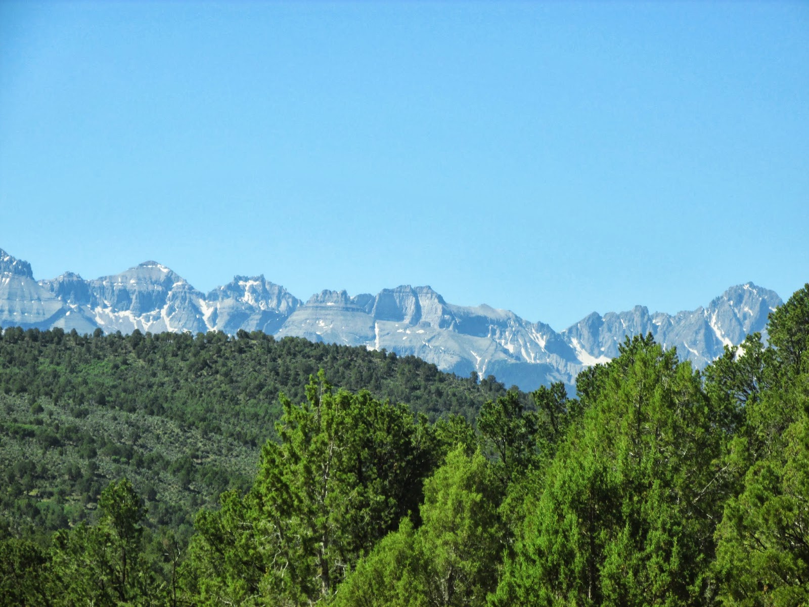
 Some views along the way as we start down the Pine Creek Trail


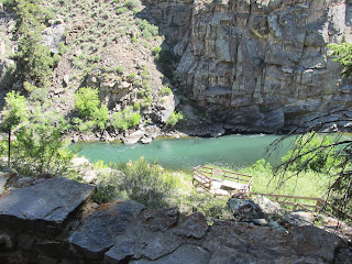
 Just as we got down to the river

 Walking along the former narrow gauge railroad bed, en route to the dock
 Beautiful flowers
 Mr. Chipmunk, with his best imploring look, "Please Santa, a bite to eat--promise I've been a good boy!"
 Looking up river just as we boarded the boat
 Gorgeous color to the water, and nice reflections on the surface
 Chipeta Falls, named after Ute Chief Ouray's wife
 Just stunning views!
 More views of Chipeta Falls


 The water was like glass for most of the day; when we got back to the dock and started walking back up the trail to the stairs that would take us back to the parking lot, we noticed that it was moving much faster, likely due to a release from the upstream dam at the end of Blue Mesa Reservoir.
 Our ranger guide on the boat showing an old logo from the Denver & Rio Grande Western RR, just as we're about to pass through the view that was used in the logo


 Great fly fishing here!


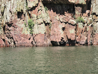
 Beautiful red sections
 Some hoodoos way up high

 This rock looked like it was about to fall any minute!

 Above, starting the hike back up the trail, below,
Interesting striation on a rock as we walked back along the trail

Trisha's a happy camper as we start down the road from the RV parking area to the trailhead that will lead us to the boat dock


Interesting striation on a rock as we walked back along the trail